June 23, 2012

Cottonwood Ridge Traverse June 20, 2012

Cottonwood Ridge from the West
 
The morning was crystal clear and I had an afternoon free of meetings so I took the rest of the day off in hopes I might take advantage of a few hours and get away from the valley heat. Scott Wetzel was able to break away too so we were stoked to head for the hill. We reached the trailhead at 1:30 PM and began our journey at Broads Fork and made haste up to the meadow below the cirque of Dromedary, Sunrise and Twins in just under 40 minutes.
Heaven on Earth

Scott bringing it to the Meadow


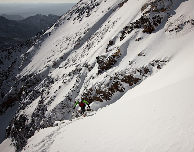
We decided to tag Twins via the direct variation and after some beautiful views of high alpine flowers, crossing some remaining veins of spring hanging snow fields we reached the upper North Ridge.
Scott peering up the Direct
 I ran over and peaked out on the black horn north of Twins and then met up with Scott as we moved up to the Summit. While on the final stretch I ran into this wild flyer who was unaware of my proximity. The sky had thin sierus clouds with indications of wind.
Majesty, From near the Black Horn


Wild Flyer North Ridge Twins East Peak
  I reached just below the east Summit of Twin and then ran over to top of the west Summit of Twin (I just had to right?), took a quick shot and ran back to the east Summit.
Looking East from Twin's West Summit
Scott on Twin East Summit
Descent off Twin


Scott, nice socks...
Twins looking south -courtesy Scott Wetzel
  
The objective of the day began to unveil itself nicely before us. We then quickly ran and scrambled down the south ridge and then moved onto Sunrise's west buttress and to its summit. Continuing we then trotted over and onto Sunrise's summit proper. The wind was gusty from the south, reminding us of the exposure below. I was feeling pretty good and cruised down the east ridge of Sunrise and over to Dromedary.

 This is where Scott and I parted ways and he needed to get home for some of his responsibilities.  Sweet day Scott!!! Scott descended down the couloir between Drom and Sunrise then out to his car. I proceeded up towards the summit of Dromedary and noticed one of the white ghosts of the Wasatch gazing directly down upon me. I moved quickly to get closer and by the time I reached the notch just below Dromedary's summit it had vanished as quickly as it had appeared. I moved to the top of the Camel's Back (Dromedary) and was cascaded by the beauty in front of my eyes. Each time I am here the same thing happens. I was humbled quickly as my ultimate objective continued to drape itself before me.
From Dromedary Looking Back @ Sunrise and Twins
On top of Dromedary
The Cottonwood Ridge looking East

 The long, spiny and exposed ridgeline leading to Superior proper stretched out seemingly endless.  I would miss the company of Scott. I looked at my watch it was 4:49 PM. If I wanted to traverse all the way to Superior on the spine I needed to cruise as I feared getting benighted on the west face of the sharp toothed Monte Cristo. Four more significant summits stood before me linked by a sharp exposed ridge. I was off, and within 10 minutes I looked back and could see my island of safety quickly drifting behind me (Dromedary).
Gazing back at Dromedary
 
From Peak 11,130 (with my phone camera)


The ridge was amazing, sharp, blocky, super exposed and at times fast to slow moving. I continued summiting a prominent 11,000 foot tooth then onto peak 11,130 which was steeper than I thought it would be. Just as I continued on the spine I dropped the batteries out of my camera. Dang. They spilled out to the south face. So now all I had was my phone camera. I could see Monte Cristo staring down as I was becoming more fatigued. Running what I could and then coming to regular haults due to the need to scramble, I finally reached the base of Monte Cristo. I was amazed at the sheer steepness of the ridge now as it abutted the base of the Mont.
Nearing Monte Cristo- just over the hump
Looking back to the start from peak 11,130 (bad phone camera-sorry)

I picked my line and continued as I had the whole way scrambling quickly up 4th class rock with the south falling precipitously below me. Beyond the 4th class, I chose to avoid the loose rock chimney and decided to head straight up the dihedral of the west face climbing perhaps some very low 5th class. As I peaked out and added a rock to the cairn indicating the summit I looked back over the miles and peaks with gratitude for the moment I was experiencing.

From top of Monte Cristo  looking back on the ridge (phone camera into the sun)
Obligatory Self Photo
 I then moved over to the summit of Superior and then descended the east ridge. I tried to not take it too laxed but it was super mellow when compared to the ridge now behind me. As I reached the bottom part of the Superior ridge I was greeted by 7 more white ghosts of the Wasatch, this time they grunted and moved away once I got within 100 feet or so. Probably my stinky scent. I don't blame them. Descending down pole line off of Cardiff I was struck by the beauty of my surroundings as I reached Our Lady of the Snows with an elapsed time of 6 hours and 24 minutes from the time I started.

Summits Reached--
Black Horn
Twin West
Twin East
Sub Sunrise
Sunrise
Dromedary
Unknown 11,000
Peak 11,130
Monte Cristo
Superior

June 16, 2012

Red Pine Baldy & White Pine Baldy Traverse

 Amazing to think at this time last year we were still skiing excellent lines while this year the high alpine is nearly dry. Crazy! I guess you need to take advantage of whatever nature dishes out. I set out this morning at 6 AM from White Pine trail head with not much of an agenda other than to mountain run.  The sun was burning the northeast faces of White Pine Baldy and Lake Peak as I entered the upper White Pine basin alone. It was truly beautiful as the trail was still wet from snow melt and a couple moose made it even more exciting. The White Pine region this morning had a wild sense to it that I have not felt for a while, it was a welcome change. As I reached the top of the White Pine switchbacks with the lake around the bend I aimed my sights straight up to the north ridge of Red Baldy in hopes I could make a dash for the summit. It was cold and my arms were chilly as I pushed up the steep face to the ridge gaining the warmth of the sun which was a welcome embrace and not an ounce of wind existed. I trotted along the razor edge and scrambled to the top of the middle summit with absolutely no one around and an elapsed time of 1 hour 20 minutes.
Nearing Summit of Red Baldy and White Pine Baldy Peering Behind w/ a bad phone camera

 I still had some time so I made haste and ran down the ridge with the east spiny ridge of White Baldy beckoning me with an irresistible force. As I reached the saddle I was so impressed by the beauty, the cloudless sky, no wind, wild flowers, shiny white granite and the solitude of running on technical terrain that I had to keep going. I scrambled along the east ridge, loving every airy step up and over detatched granite blocks until I reach the summit with 2 hours lapsed.

Red Pine Basin from Summit White Baldy w/ a bad phone camera
I paused to throw my jacket on and gaze at what little snow exists and then decided to proceed down the north ridge and then down the relentless west bowl/face of White Pine Baldy and down to the upper Red Pine Lake which still desperately sought to hang on to a winter ice. I then moved down the final snowfields and on to the trail. As I neared the car, the sun was warm, the air was clean and I along with many other folks at this point enjoyed the beauty of what these mountains provide. I stopped the watch at 3 hours 19 minutes and then drove away.

Upper Red Pine Lake w/ a bad phone camera

June 8, 2012

Lone Peak via Big Willow out Jacob's Ladder

For many years I have looked up Big Willow Cirque with an imaginary mind filled questions.  I remember some 25 years ago getting hung up on the Willow "notch" unable to grasp the Summit of Lone Peak from our weary camp down in upper Bells Canyon. I have approached Lone via Draper Ridge and Hammongog but never the less conventional and more challenging Big Willow.  With a day off work and an nagging need to get it done, I departed my car at 5:40 AM with a camelbak, 80 oz of water, short ice axe, gators, light gloves, hat, small first aid kit, wind breaker and feet shod with my masochist trail runners. The wind was steady as I quickly made my way up the Saw Mill trail which was new ground for me and luckily I turned left at the sign junction and ran any runnable stretches.
Saw Mill
Mid Way up Big Willow
 After reaching the second major terrace and after serious shwacking among the short brush on a very faint trail, the magic show began. I think the travel should be much more efficient in the winter in this area. The sun was burning the north east faces of the south end of the canyon and I suddenly found myself to be a small figure among giant granite walls that were like sharp teeth all around me.

The Magic


The Big Willow Head Wall
My line was easily sized up as I gazed up the south head wall which guards the summit of Lone Peak proper. The environment around me was stunning and the "notch" filled my view as there was no one around but me and the enigmatic cirque. Energized by my Snickers with Almonds I ran into the cirque with trepidation as the snow was rock hard and steep. Jogging up the snow field, it became too steep to travel without my axe in hand so I unsheathed to continue the ascent. Feeling like a child at Disneyland I was excited to be where I was and moved up the head wall, slipping a lot in my trail running shoes and grateful for the axe.

Looking west below the Head Wall
 I then moved out onto the steep scree slope which had new remnants of rock slides as the granite sand was deep and moved with every step. Going back and forth between very solid snow and sand and loose rock I made my way to some solid granite that allowed for some climbing moves and on up to the ridge I went. I stopped to take a few pictures and then set out running on the rocky ridge and then up to the final push reaching the summit of Lone Peak. 2 hrs 23 minutes had elapsed. I gazed around, tried calling my wife who was still in bed no doubt and then boogied on down the ridge.
The Notch

Looking Down Big Willow

Lone from top of Head Wall

Question Mark Wall from Summit of Lone Peak

Obligatory aging self portrait
Knowing of the risk of down climbing the impenetrable snow on the Big Willow head wall without front points I thought to descend the Jacobs Ladder trail and traverse the mountain. As the Lone Peak cirque filled my back drop, I recalled the great times I have had climbing routes up the west walls. Lone is a most stunning movie screen with many films of success and tragedy that have been cast upon her walls. It is a special place.
Heaven on Earth

Paintbrush in Bloom
After about 25 minutes of getting lost down towards the Hammongog drainage and then climbing all the way back up to Draper Ridge I reclaimed the trail a bit frustrated. I found the Jacob's trail and ran down it with plans to have my wife pick me up on corner canyon road at the end of the trail. I called her and she didn't seem interested (rightfully so) so I decided to now create a loop of it.  I reached the bottom of the Jacobs trail head at 4 hours 19 minutes elapsed.   I now had about 5 miles ahead of me as I ran down the dirt road and then hooked up the shoreline trail and ran it to the church and trail head of Big Willow from where I started. 5 hours and 11 minutes had elapsed since I started the watch a series of wonderful experiences ago.

The End

June 2, 2012

Memorial Day in the Pipeline

Jason  sent the text Sunday night asking if I could ski in the morning. The storms had been brewing in the high mountains over the weekend and I could see a faint dusting of snow on Twin's west face. We couldn't tell how much depth was really there but I knew I had to get another day in the alpine on skis as the ever impending doom of summer was quickly befalling us.  Meeting Jason at 5:40 AM is always a treat, he is all smiles and ready to roll towards another objective in the mountains. His boundless energy is so inspiring. We have had some outstanding ski adventures together and this promised to be another one. 6:00 AM we threw our packs on which had minimal water, some food, a down jacket and light crampons and a shovel and speedily found snow about 200 feet from our vehicle. With skis on we made haste and moved efficiently up the ski run of Snowbird resort with our objective looming high above us. The Pipeline Couloir, known for its aesthetic beauty which makes a snake like mark down the northeast face of American Fork Twins West Peak was our aim and with the resort closed for the season and with no one but us, a light breeze, cold temperatures and some moose tracks, we knew the Pipeline was ours.  Before we knew it we had reached the bottom of the Little Cloud lift and speedily skinned through the brand new lightweight white stuff into the apron of the couloir. Conditions seemed reasonable as we regularly tested the slopes.


Setting Booter- Photo by JDorais
 With the sun now shining pouring rays out of a clear blue sky onto the glorious alpine setting our spirits were lifted to the point of setting a booter at a quick pace and then along the ridge avoiding the steep open slope of the entry point of the couloir.  There must have been 18" of new snow which was rapidly going through metamorphosis.
Nearing top of Couloir on Ridge - Photo by JDorais
  We then threw on the skis for the final push to the summit of the West Peak and then had some simple scrambling over loose snow, rock and ice to the top.
Entering Couloir- Photo by JDorais
It was an incredible morning and in just a few moments we were skiing off the summit then down climbing the rocky section and putting the skis on for the last time and entered the couloir after a fruitless ski cut. 
Midway down the Couloir- Photo by CAmbrose

Midway - Photo by JDorais
The Apron- Photo by CAmbrose
 The powder was light and the line skied better than it had all year I suspect. All the way down to the car we laughed about how incredible the morning was. In less than 2 hours and 45 minutes round trip we were on our way home to celebrate Memorial Day.